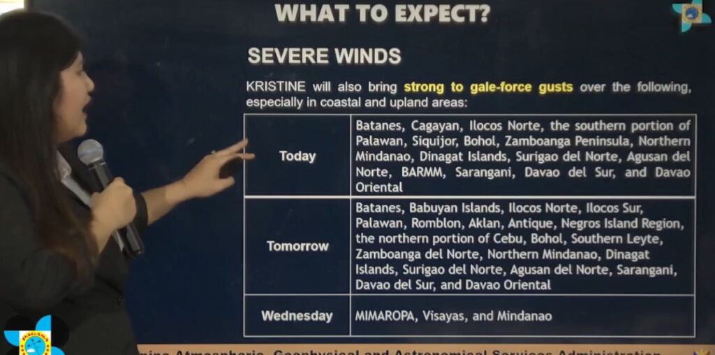
The state weather bureau emphasized Monday the importance of preparedness, particularly in areas already placed under Tropical Cyclone Wind Signal No. 1.
“Kahit malayo pa si Kristine sa kalupaan, malawak ang sakop ng kanyang cloud band kaya apektado na ang ilang bahagi ng Bicol at Eastern Visayas. Inaasahan natin ang malalakas na pag-ulan sa mga lugar na ito na maaaring magdulot ng pagbaha at landslides,” Philippine Atmospheric, Geophysical, and Astronomical Services Administration (PAGASA) administrator Dr. Nathaniel Servando said in a press briefing.
Kristine is currently moving west-southwest at 30 km/h, with maximum sustained winds of 55 km/h near the center and gustiness of up to 70 km/h. It is expected to slow down to 15 km/h over the next 48 hours as it intensifies.
The affected areas under Signal No. 1 include Bicol, Samar, Leyte, and parts of Northern Mindanao and Luzon, according to PAGASA weather forecaster Veronica Torres on the forecast track during the briefing.
“Projection natin na ang bagyong Kristine ay tatama sa hilagang bahagi ng Luzon sa Biyernes ng umaga. Pero dahil sa lawak ng kanyang sirkulasyon, apektado rin ang Central Luzon at Bicol. Pinapayuhan natin ang mga residente na maghanda para sa malalakas na ulan at storm surge,” Torres explained.
She said Kristine is still far from land, with an elongated circulation mostly affecting the eastern parts of Southern Luzon and Visayas. However, its trough or extension is already impacting almost the entire country.
As Kristine progresses, its area of probability continues to expand.
“In the next 12 hours, posibleng lumakas at maging isang tropical storm itong si Kristine. Severe tropical storm by Wednesday (October 23) and possibly typhoon category by Thursday (October 24) evening or Friday (October 25) morning, bago ito mag-landfall sa northeastern portion ng Cagayan,” she added.
The forecast also indicated potential changes in Kristine’s track as it nears land. Torres stated that it is expected to slow down, which could result in strong gusts of wind and heavy rainfall.
Dr. Servando stressed that the public should take all warnings seriously and advised fishermen in affected areas to avoid venturing out to sea.
“Inaasahan natin ang mapanganib na kondisyon sa dagat na may alon na umaabot ng 4.5 metro, lalo na sa silangang bahagi ng Luzon at Visayas. Huwag na munang pumalaot ang mga mangingisda,” he warned.
During the press conference, reporters asked how Kristine compares with previous storms.
PAGASA Senior Hydrologist Rosalie Pagulayan likened the storm’s trajectory to that of Typhoon Lawin in 2012, which followed a similar path toward Northern Luzon.
“Halos pareho ang direksyon ni Kristine kay bagyong Lawin noong 2012 na tumama rin sa hilagang bahagi ng Luzon. Kaya patuloy natin itong binabantayan dahil maaaring magdala ito ng malakas na ulan at hangin,” Pagulayan added.
PAGASA also confirmed that local government units (LGUs) in the affected areas are now coordinating with the Office of Civil Defense (OCD) for possible suspensions of classes and work. While no official declaration has been made yet for Metro Manila, advisories are expected by midweek.

