 Peter Beattie
A number of homes have been flooded in counties Down and Tyrone following hours of heavy rain and wind caused by Storm Bert.
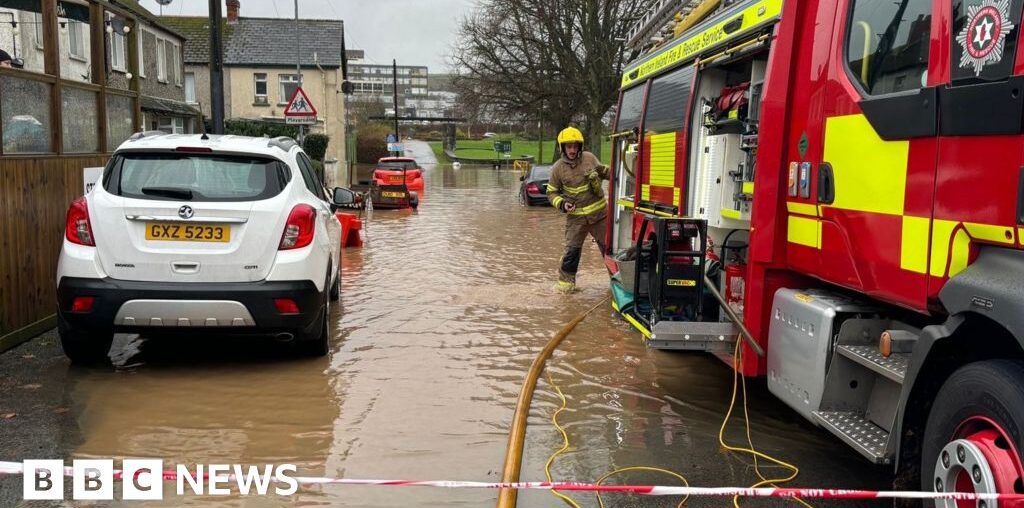
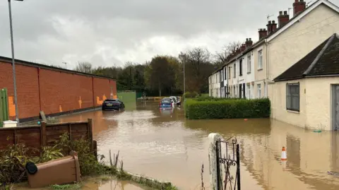
Some residents in Dundonald were stuck in their houses due to the flood water while up to 10 homes may have been flooded in Coalisland.
Travel has been heavily disrupted, with roads and train lines affected by flood water, fallen trees and other debris.
The railway line between Belfast and Antrim remains closed, while the line between Belfast and Dublin has reopened after being shut earlier, public transport operator Translink said.
About 3,500 customers are without power, with most of those in the south east and north west.
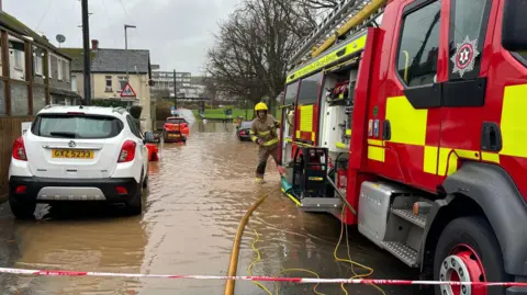
Three fire appliances were deployed to protect homes at Park Avenue in Dundonald, according to Fire Service Group Commander Danny Ard.
Meanwhile, homes at Kings Row, Coalisland, have also been hit.
Mid Ulster councillor Dan Kerr told BBC News NI he had been contacted by three or four residents whose homes have been flooded.
He said firefighters and staff from the Rivers Agency were at the scene and sandbags had been secured from a nearby Gaelic Athletic Association (GAA) club.
Mr Ard said the number of flooded properties could be as high as 10 but firefighters cannot confirm a final figure until the water has receded.
The group commander added that a mail distribution centre in Mallusk, Newtownabbey has also been flooded.
Three pumping appliances and one high-volume pump are being used to take the water away.

 Peter Beattie
At the scene: Residents trapped
by Linzi Lima, BBC News NI reporter in Dundonald
The fire service is pumping water at Park Avenue, where a number of residents cannot get out of their houses.
Kelly Kitchen’s son and his partner are among those residents. She says her son told her he woke this morning after 09:00 to find his house had been flooded.
He hasn’t been able to leave. A video of his home shows a fridge floating in the kitchen and a couple of feet of dirty water on the ground floor.
The fire service arrived after 09:00 and have been pumping the excess water since. It is receding slowly as residents watch. Some have gone to the nearby church hall to stay warm and dry while the operation continues.
Travel disruption
Allow Twitter content?
The strongest winds in Northern Ireland – at 67mph – were recorded in Ballypatrick, County Antrim, while Derrylin in County Fermanagh recorded a quarter of its average November rainfall in 12 hours overnight.
Earlier, the TrafficWatchNI service reported “very difficult driving conditions” in some higher areas including the Glenshane Pass, Windyhill Road in Limavady and Glenpark Road, Omagh.
A gritter vehicle got stranded in snow on the Coleraine Mountain Road, which also was closed for a period.
In addition to the snow:
- A number of roads have been closed due to rock falls, landslides and fallen tress – the Greenhill Road, on the A4 near Brookeborough, County Fermanagh, is closed due to subsidence at a bridge. The latest on road closures can be found on the TrafficWatchNI website.
- The Broadway roundabout in Belfast was briefly closed due to flooding near the Royal Victoria Hospital.
- P&O Ferries cancelled Saturday’s 04:00 GMT ferry between Larne and Cairnryan but said passengers would be accommodated on the 08:00 sailing.
- Ballymena United’s football match against Larne was called off because of a waterlogged pitch at Ballymena Showgrounds.
Translink has list of all its disrupted bus and rail services on its website.
 Pacemaker
Status red warnings
In the Republic of Ireland, about 34,000 homes are without power, after Storm Bert descended overnight.
Met Éireann (the Irish Meteorological Service) had issued red warnings for heavy rain in west Cork and west Galway.
Images posted online appeared to show that the River Feale in west Limerick had burst its banks.
In County Donegal there has been major flooding on Bridge Street in Killybegs.
It was one of the worst hit counties for power cuts while the highest wind gust recorded on the island of Ireland was 71mph (114kph) at Malin Head in the county.
Allow Twitter content?
More strong winds coming
by BBC News NI weather presenter Cecelia Daly
Storm Bert has not finished with us yet. A fresh batch of strong winds will develop on Sunday and the Met Office has issued a yellow warning for strong winds, valid from 11:00 to 18:00 GMT on Sunday.
There has been a significant reduction in the wind on Saturday afternoon, but they will freshen again overnight.
The earlier heavy rain combined with snow melt has led to flooding in many areas as rivers burst their banks. Flooding will continue to be a hazard as snow melt feeds down into the river network.
According to the Met Office: “Strong southwesterly winds are expected to develop during Sunday morning across Northern Ireland.
“Gusts of 45-55 mph are expected widely with gusts of up 65 mph possible over hills and exposed locations around the coast.”
The top wind gusts will be similar to those of Saturday and therefore could cause some further damage and disruption.
Why and how are storms named?
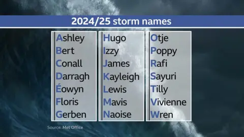
The naming of storms is a practice which helps meteorologists communicate with the public when they need to advise of dangerous or disruptive weather events.
Bert is the second named storm of the 2024/25 season which began on 1 September.
It was named by Ireland’s Met Éireann on Thursday because Irish forecasters believed it could bring severe disruption to the Republic of Ireland.
Met Éireann works in partnership with the UK Met Office and the Royal Netherlands Meteorological Institute (RNMI) every year to monitor, classify and names storms.
The three organisations agree an alphabetical list in advance of each season.
